Cad Files
Upload yours
[+]
3D studio
blocks
building
detail
law
map
other
picture
rhino3d
sketchup
software
aerial photo
geographic map
logo
materials
pano
photomontage
sky
textures
Foto Aerea Santiago
aerial photo - [.jpg]
plaza italia
aerial photo - [.jpg]
foto aerea de lautaro
aerial photo - [.jpg]
Paris Google 4800x3347 px
aerial photo - [.jpg]
Concepcion, Chile
aerial photo - [.JPG]
Salvador de bahia, Brasil
aerial photo - [.JPG]
Viña del Mar, Chile 01 1:40mil
aerial photo - [.jpg]
Puerto Cisnes, Cohaique I (el norte esta hacia abajo)
aerial photo - [.jpg]
Puerto Cisnes, Cohaique II (el norte esta hacia abajo)
aerial photo - [.jpg]
Curanipe, Linares, Chile
aerial photo - [.jpg]
San Joaquin - La granja, MIM, Santiago, Chile
aerial photo - [.jpg]
San Joaquin - La granja, MIM, Santiago, Chile
aerial photo - [.jpg]
La cisterna y San Ramon al norte, El Bosque y La Pintana al sur, Santiago, Chile
aerial photo - [.jpg]
Naltagua
aerial photo - [.jpg]
Laguna grande san pedro de la paz
aerial photo - [.jpg]
Parque de los Reyes, stgo, chile
aerial photo - [.jpg]
Santiago, chile
aerial photo - [.jpg]
Cartagena
aerial photo - [.jpg]
Brasil, Rio negro y rio solimoes
aerial photo - [.jpg]
aerial photo - [.jpg]
Sewell
aerial photo - [.jpg]
Viña del Mar, Chile 03 1:40mil
aerial photo - [.jpg]
Viña del Mar, Chile 02 1:40mil
aerial photo - [.jpg]
Ruta 5 sur
aerial photo - [.jpg]
Talcahuano, Chile
aerial photo - [.jpg]
Corinto
aerial photo - [.jpg]
La serena, Chile
aerial photo - [.jpg]
Chuquicamata, Chile
aerial photo - [.jpg]
Santa Juana VIII Región, Chile
aerial photo - [.jpg]
San Pedro de la Paz
aerial photo - [.jpg]
Concepción, Chile
aerial photo - [.jpg]
Region Metropolitana, Chile
aerial photo - [.jpg]
Concepcion III, Chile
aerial photo - [.JPG]
Barcelona - Eixample
aerial photo - [.jpg]
Isla de Pascua
aerial photo - [.jpg]
Barrio Lastarria, Stgo Chile
aerial photo - [.jpg]
Estacion Mapocho, Stgo Chile
aerial photo - [.jpg]
Laguna en ciudad
aerial photo - [.jpg]
CAUQUENES, CHILE
aerial photo - [.jpg]
Campiña
aerial photo - [.jpg]
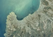
Alguna costa de algun lugar
aerial photo - [.jpg]
Castro, Chile
aerial photo - [.jpg]
Santiago, eje republica
aerial photo - [.jpg]
Santiago de Chile
aerial photo - [.jpg]
Concepcion I, Chile
aerial photo - [.JPG]
Concepcion II, Chile
aerial photo - [.JPG]
Santiago, Chile. Estacion Mapocho
aerial photo - [.jpg]
Sidney, Australia
aerial photo - [.jpg]
New York, USA
aerial photo - [.jpg]
San Francisco, USA
aerial photo - [.jpg]
Isla de Pascua, Chile
aerial photo - [.jpg]
Lima, Perú
aerial photo - [.jpg]
Cataratas Niagara, USA
aerial photo - [.jpg]
Valparaiso
aerial photo - [.jpg]
Valparaiso - Viña del Mar
aerial photo - [.jpg]
Bilbao, Pais Vasco
aerial photo - [.jpg]
Washington DC
aerial photo - [.jpg]
Istambul, Turquia
aerial photo - [.jpg]
Paris
aerial photo - [.jpg]
BUENOS AIRES
aerial photo - [.jpg]
Cordillera de Los Andes
aerial photo - [.jpg]
Temuco, Chile
aerial photo - [.jpg]
Rancagua; Chile
aerial photo - [.jpg]
Concepcion, Chile
aerial photo - [.jpg]
San Felipe, Chile
aerial photo - [.jpg]
Foto Aerea cerrillos
aerial photo - [.jpg]
Stgo Centro. Palacio de la Moneda
aerial photo - [.JPG]
Santiago. Estacion Mapocho
aerial photo - [.JPG]
Santiago. Cerro Santa Lucia
aerial photo - [.JPG]
Concepcion Talcahuano
aerial photo - [.JPG]
San Pedro VIII Region, Chile
aerial photo - [.jpg]
Santiago. Cerro Navia. Norte Sur y Hospital Ochagavia
aerial photo - [.JPG]
Santiago. Cerro Navia
aerial photo - [.JPG]
Barcelona, España
aerial photo - [.jpg]
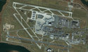
Scl Aeropuerto de Santiago de Chile
aerial photo - [.jpg]
Piramides de Egipto
aerial photo - [.jpg]
Aeropuerto de Vancouver
aerial photo - [.jpg]
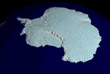
Antartica desde el espacio
aerial photo - [.jpg]
Holanda. Estrella de Bourtange 1:3000
aerial photo - [.jpg]
Mapamundi en colores
aerial photo - [.jpg]
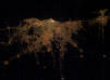
El mundo de noche. Brasil desde el espacio
aerial photo - [.jpg]
Contulmo
aerial photo - [.jpg]
Lago Lleu-Lleu
aerial photo - [.jpg]
foto ciudad rengo
aerial photo - [.jpg]
san jose de maipo
aerial photo - [.jpg]
Foto aerea desembocadura de un rio
aerial photo - [.jpg]
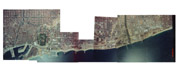
Foto Aerea Santiago Norte.
aerial photo - [.jpg]
Punta Arenas, Chile. Lat 53° 00´ Long 70° 00´
aerial photo - [.jpg]
Valparaíso, Chile. Lat 33° 15´ Long 71° 45´
aerial photo - [.jpg]
Puerto Montt, Chile. Lat 41° Long 71° 45´
aerial photo - [.jpg]
Concepción, Chile. Lat 36° 45´ Long 73° 15´
aerial photo - [.jpg]
Santiago de Chile, foto aerea a color
aerial photo - [.jpg]
Santiago de Chile. Comuna de Pedro Aguirre Cerda
aerial photo - [.jpg]
Santiago de Chile, región metropolitana
aerial photo - [.jpg]
Santiago de Chile, Centro de la ciudad.
aerial photo - [.jpg]
Santiago de Chile
aerial photo - [.jpg]
Arch
Art
Dsgn
Ilus
Photo
CAD
Log In
Log In
Sign Up